Unearthing Geologic Mysteries in 4 Northeast Michigan Parks
Would you like to save this full guide?
The lumberjack puffed on his cigar and straddled a log. Bobbing up and down in the water, he steered the log into a sinkhole and vanished from sight. Days later, he reappeared in Lake Huron’s Misery Bay, still sucking on a cigar.
This colorful legend originated during Michigan’s logging era, and is one of many involving Northeastern Lower Peninsula’s karst landscape. These geological formations are created when water erodes bedrock, such as limestone, which is widespread in this part of Michigan, resulting in sinkholes, caves, cracks, and valleys.
What is karst?
A type of landscape where water erodes bedrock, such as limestone, resulting in sinkholes, caves, cracks, and valleys.
Map of Geological Mysteries in 4 Northeast Michigan Parks
Luckily for Michiganders, the counties of Presque Isle and Alpena boast a wealth of karst features with more than 200 sinkholes. While many of these are on private property, there are several that are open to the public.
Below you’ll find an introduction to the area’s most accessible sinkholes, offering biking and hiking trails, along with an opportunity to experience this unique geology closeup.
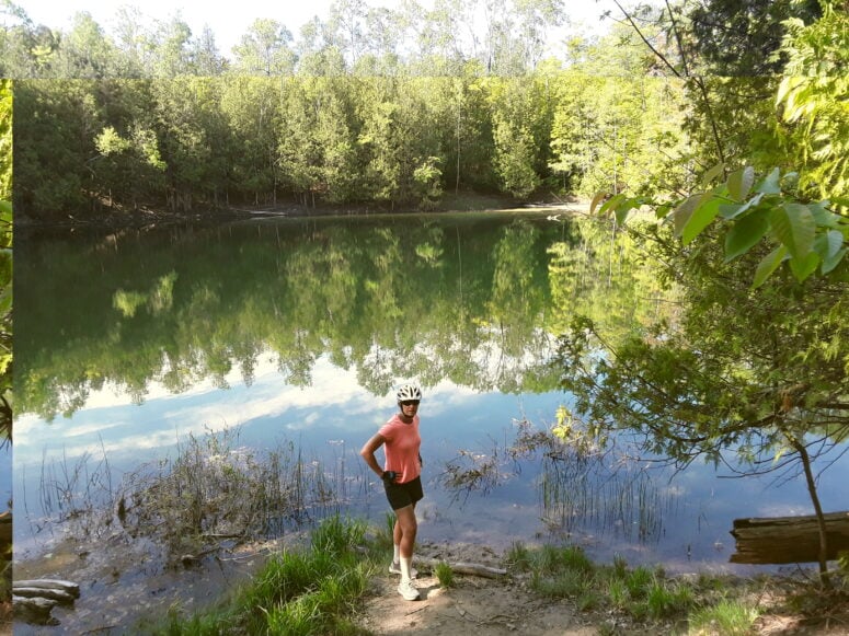
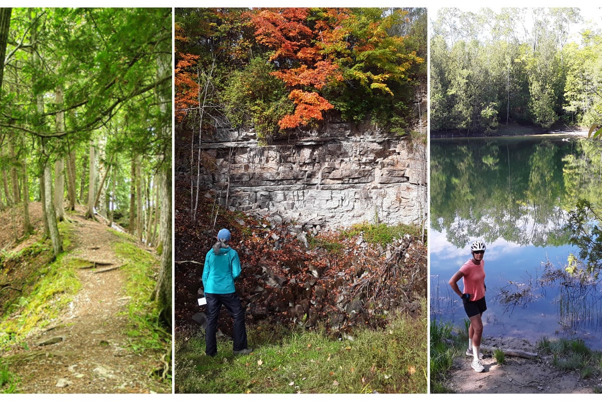
Rockport State Recreation Area
Located about 12 miles north of Alpena, Rockport State Recreation Area is home to 13 sinkholes, with one plunging into the earth more than 100 feet. Rocky singletracks and doubletracks loop about 19 miles throughout the area, allowing visitors to explore the terrain by foot or bicycle.
Combining an old quarry with Lake Huron frontage, Rockport merges multiple terrains, where one can pop out onto a beach and then, a few minutes later, look down into a sinkhole. Mountain bikers will appreciate the trail that hugs the edge of the quarry as it dips around scrubby trees and rolls over rocks, boulders, and roots.
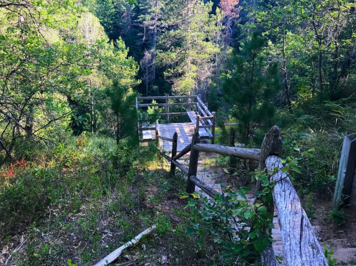
Sinkhole Pathway
This 2.5-mile trail, about 12 miles southeast of Onaway (near Shoepac Lake State Forest Campground), rolls around 5 sinkholes, climbing and dipping as it rambles through the forest. Steps lead down to a viewing platform, allowing one to gaze into a deep sinkhole. It’s rare to see other people, creating an atmosphere of solitude, where the rush of wind is sometimes the only sound.
Across the road sits Shoepac Lake, another example of a sinkhole, and adventurous hikers and bikers can access the 80-mile High Country Pathway, just down the road from the trailhead.
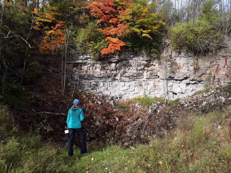
Mystery Valley Karst Preserve and Nature Sanctuary
Hosting a collapsed valley, considered to be one of the Great Lakes’ largest, Mystery Valley is a collection of sinkholes, cracks, and caves. Transitioning between meadows and woods, the preserve, located about 6 miles south of Posen, off Leer Rd., offers two short trails:
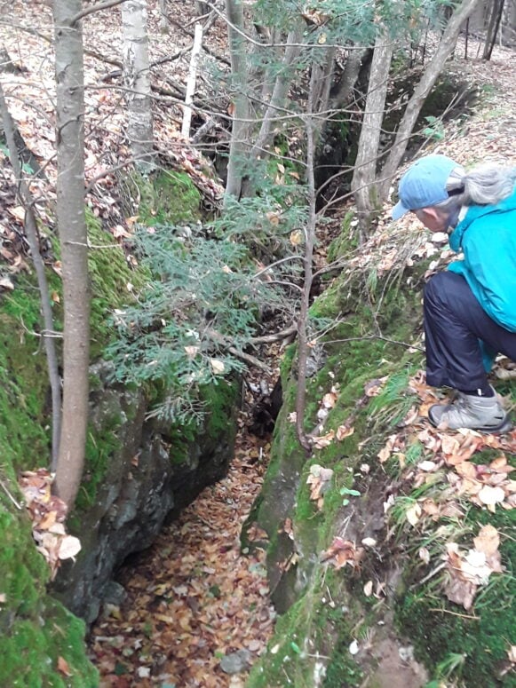
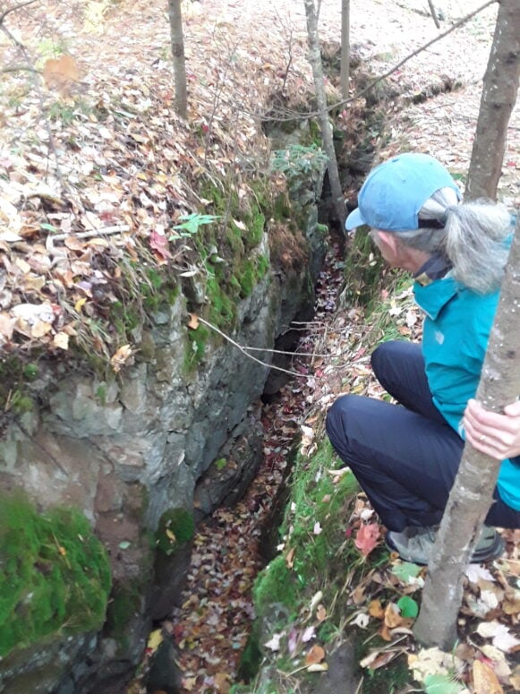
- The one-mile Earthcrack Trail wanders past several cracks slicing deep into the earth, with one that is hundreds of feet long.
- The half-mile Valley Trail highlights fossils about 350 million years old and leads to a sinkhole lake. When dry, hikers can continue along the trail and view the rock-walled sinkhole, which drains toward Lake Huron.
Bruski Sink and Stevens Twin Sinks
Near Mystery Valley, also off Leer Road, rest three additional sinkholes. Short trails meander throughout the properties, running next to cracks in the earth or along a ridge that splits the Stevens Twin Sinks.
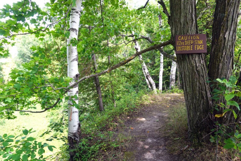
Sadly, the Bruski Sink had been used for years as a garbage dump when it was donated to the Michigan Karst Conservancy in 1996. Nine years and 27 feet of trash later, the sinkhole was finally cleaned, and its depth went from 85 feet to a remarkable 112 feet.
Here, you’ll find yourself peering into the bottom of these formations at the top of trees, speculating about the microclimates that sinkholes create. It’s easy to imagine discovering your own secret valley, where rocky ledges beg for exploration and creeks converge, slipping over boulders and limestone ledges.
Somewhere a hawk cries, and a fox watches from the rim of a sinkhole. The trees close around you and civilization vanishes. Exploration is the only possibility and the 21st century seems far away, part of the wonder of karst landscapes, a Michigan marvel to be enjoyed and preserved.
Read more: From an Underground River to a Sacred Rock: 4 Northern Michigan Hidden Gems